Release 1.0.12
Tide and current station data from NOAA is now available directly on the map.
How it works
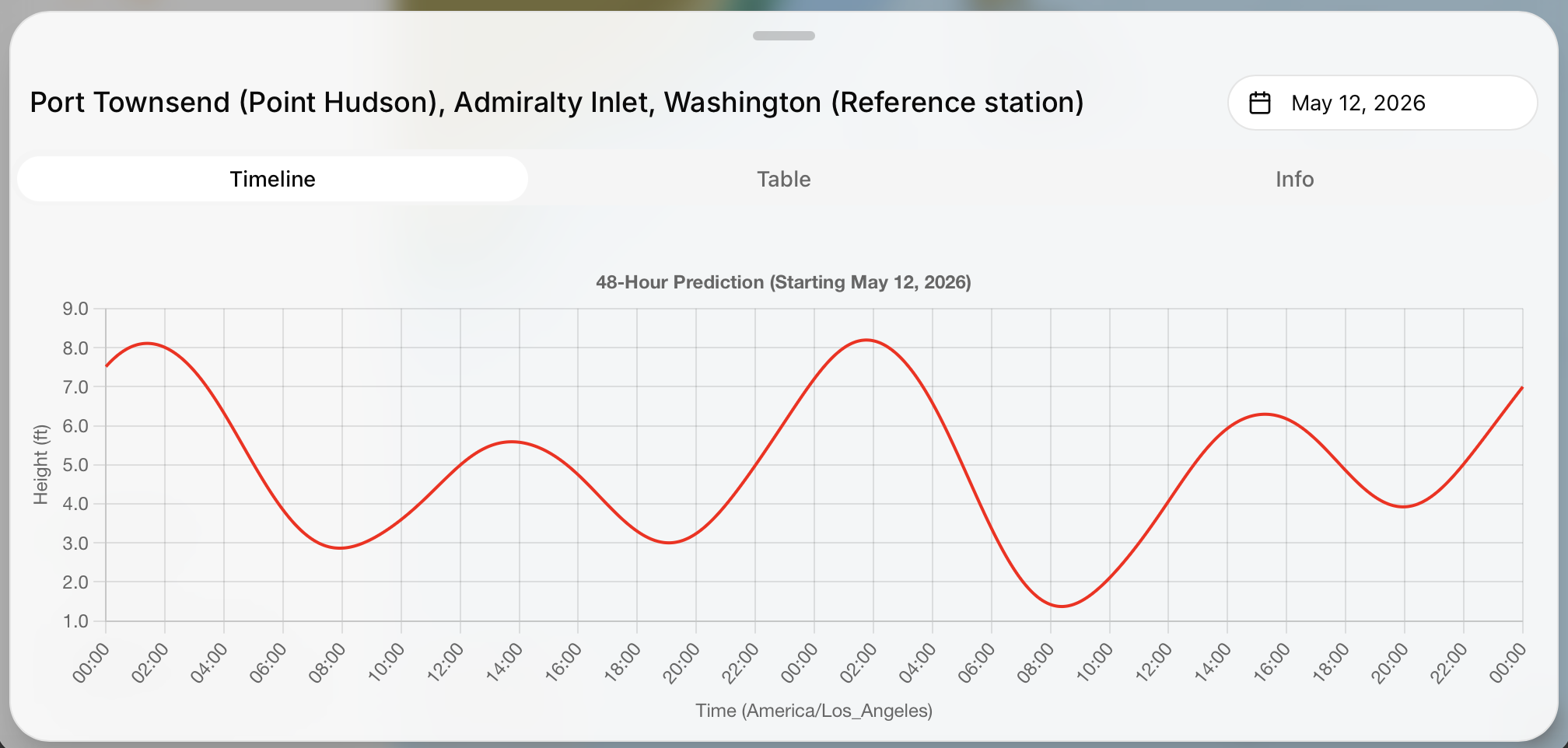
NOAA maintains a network of tide and current stations along the coast. In 1.0.12, these stations show up as icons on the map. Tap one and you get the latest predictions: water levels for tide stations, flow speed and direction for current stations.
Graphs and tables
The data comes in two views: a graph showing the predicted curve over time and a table with specific values at each hour. Both are generated from NOAA's published predictions, so you're seeing the same data you'd get from their website or a dedicated tide app.
No internet required
A database of tide and current data is included in the app, so they're available offline. Tap any station you've visited before and the information is there, regardless of connectivity.